
G.Dh. Dhigulaabadhoo
- Gaafu Dhaalu
About this area
Loading map…
The map could not load. Check your connection and try again.
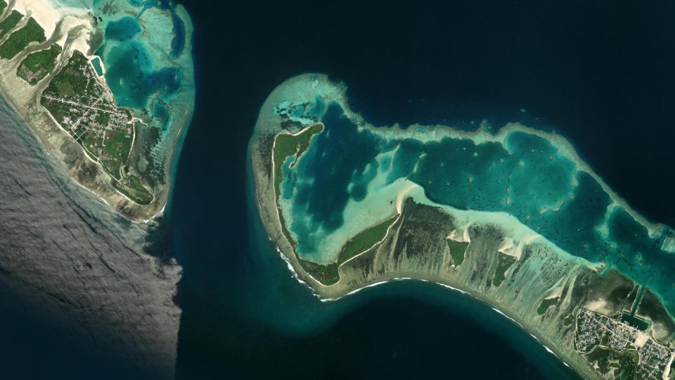
G. Dh. Dhigulaabadhoo is an island that is different in its formation compared to other islands and one that has special environmental elements. Most parts of the island are covered by mangroves and wetlands. The shape of the island also forms areas that resemble a natural cul de sac. These, along with other natural, environmental features, make this island different from others. Because this island is environmentally special, it has been included in the ‘Environmental Sensitive Areas List’ compiled by the Environmental Protection Agency. Moreover, the diverse species of animals, delicate areas and organisms on this island have been identified through research.
The natural environments of Dhigulaabadhoo can be divided into 6 categories:
1. The island’s tree line
2. The mangrove connected to the sea (Finihaka Kulhi)
3. 5 salt and fresh water mangroves and the wetlands surrounding them
4. The area where seagrass grows
5. The island’s shore
6. The reef and lagoon area of the island
How to visit. Booking is not available online for this area. Contact us for details.
Permits
-
Apply on their portal: Research Permit (opens in a new tab)
Research Permit
Issued by Environmental Regulatory Authority (ERA)
To conduct research in a Protected Area. A research permit is required. The research permit is given by Environmental Regulatory Authority (ERA). Please use the provided link to submit a research permit application to ERA.
Facts
- Status
- Designated
- Total Area
- 487.00 ha
- WDPA ID
- 555697558
- Protected Area Category
- Category 7 - Protected Area with Sustainable Use
- Date of Protection
- 07 October 2018
Resources
Open in the Knowledge RepositoryEcological Report
-
Biodiversity Assessment and Ecological Habitat Mapping of Environmentally Sensitive Sites at Huvadhu Atoll
Research, Reports and Publications PDF English No Dhivehi yet
Iulaan
-
2018_ Rasdhoo Madivaru-Farukolhu-Dhigulaabadhoo_eng
Laws, Regulations and Policies 2018 PDF English No Dhivehi yet
-
Rasdhoo Madivaru, Farukolhu and Dhigulaabadhoo
Laws, Regulations and Policies PDF Dhivehi